

205 km from the Niesen
Check out the complete analysis of a classic 200-km flight starting from the Niesen Pyramid in the Bernese Oberland.
From in-depth aerological analysis to the selection of alpine transitions and in-flight pace management, this route showcases the exceptional potential of the Swiss Alps for experienced pilots looking to push their limits in distance paragliding.
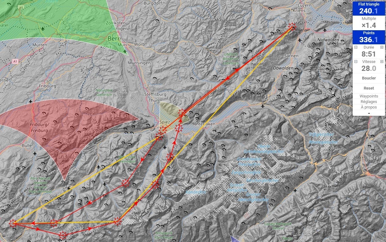
The planned route and key points along the way
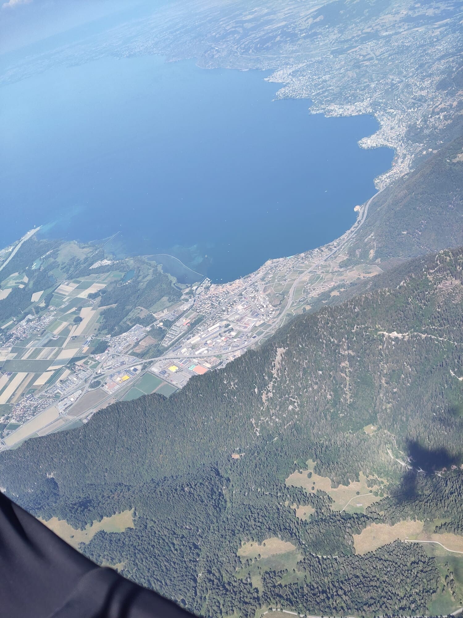
This is the classic route starting from the Niesen. I had planned a 240-km flight that day. The first leg took me to the Aï Towers, above Leysin. The key sections are the first transition above the Lenk Valley, the Wispile area, and the Diablerets area, in order to place a waypoint as far west as possible, with a superb view of Lake Geneva.
I had planned the return route further south, following the main mountain range to Lenk, before descending again over Adelboden and Kandersteg, and finally crossing the Lake Thun to the Sigriswiler Rothorn. this route is more secure if you are a bit late, because the south est ridge of the Niesen can be a little bit less good from about the middle of the afternoon
The rest of the flight was planned to go as far east as possible, following the first ridges of the Emmental and Entlebuch, helped by the north wind forecasted. It is sometimes possible to really flight almost in a straight line along those ridges.
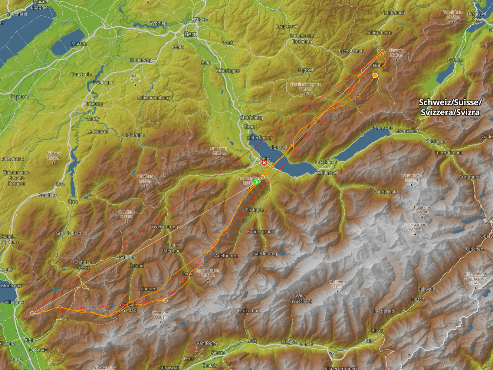
the actual route
Almost everything worked as planned.
It was possible to fly so fast between the Niesen and the Aï Towers—averaging over 34 km/h—and the cloud bases were already so high -nearly 3,800m - on the return trip above the Wispile region, that I decided to head back to the Niesen ridge before crossing Lake Thun.
Then, I followed the plan until I turned back a little prematurely, for several reasons that we’ll discuss later, in the Fluhli area.
in-flight strategy
For the first part of the flight, starting from the Niesen, I almost always follow this strategy:
- Catch the first thermal at the Niesen until it loses strength
- Head toward the Albristhorn while circling as little as possible, keeping in mind that “if you circle, you lose”
For the rest of this part of the flight that day, a northeasterly wind was pushing me in the right direction, making progress toward the Aï Towers extremely fast and easy. The usual difficulties in this sector seemed like mere formalities.
Once I’d made the turn near Lake Geneva, the return flight “up wind” turned out to be easy. In fact, the northeasterly wind, which was strong up to about 3,000 meters, died down significantly in the upper layers. This allowed me to continue making rapid progress, even on this leg of the flight.
The thermals weren’t particularly strong, but by always looking for the best thermals on the upwind side, I managed to find the best lift quickly each time, all the way back to the Niesen.
Given the day’s cloudbase, crossing the lake was a formality. I arrived with a comfortable high above the siegrieswiller Rothorn.
Once on the eastern side of the lake, I had to adapt my flight strategy from what had been planned. The wind was more easterly than forecast in this region, so I couldn’t simply rely on thermo-soaring along the magnificent ridges between Lake Thun and Lake Lucerne.
In fact, I had to continue with the classic strategy: circle—transit
That’s when I had to make a strategic decision. After a small mistake—failing to circle a thermal all the way to the ceiling to reach the next ridge—I faced a wall of easterly wind, the meteorological wind reinforced by the valley wind - and I had to dive a little bit north to find a lifesaving under the wind thermal.
That’s when I decided to head back to land at Spiez as quickly as possible, seeing the clouds turning pitch black in the area where I’d started the flight.
Two thermals and transition later, I had more than enough glide ratio to complete the flight and land at Spiez.
Looking back, I think I pushed a little too hard to complete this flight, given that thunderstorm gusts swept through the landing area just 30 minutes after I touched down.
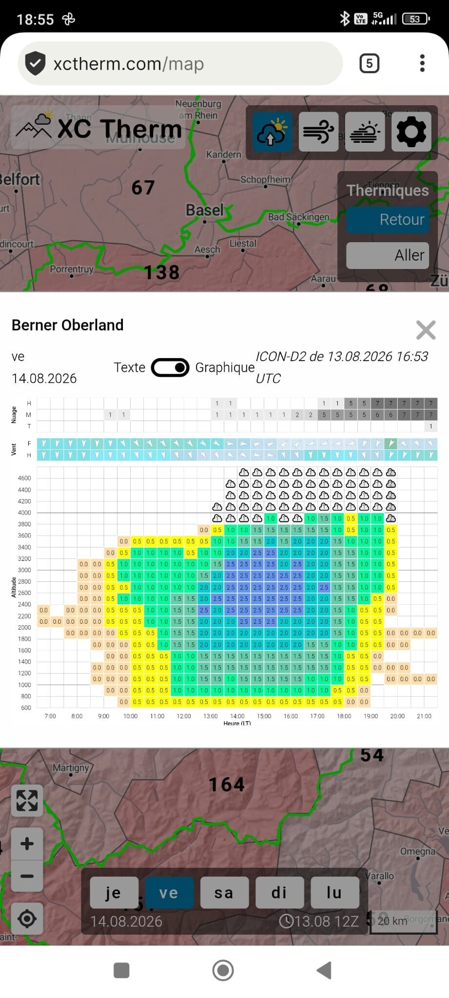
weather forecast
The weather was scorching that day, which is why the cloud bases were extremely high for the Pre-Alps.
There was a fairly high risk of thunderstorms over the Valais, and a lower but still significant risk over the Pre-Alps. The detailed forecast called for the first rain around 2:00–3:00 p.m. in the Diablerets region, as well as precipitation starting around 3:00–4:00 p.m. in the Grindelwald region. That’s why I chose the route toward the Emmental—it leaves an escape route toward the plains in case a thunderstorm develops.
I also knew I had to fly fast to complete the flight before the thunderstorms developed, which I fortunately managed to do.
The most important factor was the tendency for winds to be stronger below 3,000 m than above—I really had to take advantage of that to make progress with the wind, not against it. The wind direction and strength changed slightly between the evening forecast and the actual conditions that day.
As you can see in the image, the thermal forecasts were excellent, but predicted rather weak thermals before 12:00. You have to know your flying area to realize that on the Niesen ridge, thermal activity often begins before the forecast, thanks to favorable local conditions.
Take off southeast with a northeasterly wind?
When the wind at 2,300 m is forecast to be between 5 and 10 km/h, the thermal breeze takes over on the Niesen slope, making it possible to take off.
Link to the flight : https://www.xcontest.org/world/en/flights/detail:pierro/14.8.2026/08:00